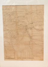
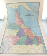
1890 SUPER RARE VERY LARGE OFFICIAL QLD GOV MAP OF “ENVIRONS of NORMANTON"

$599
Condition:
Used
Shipping:
$8 (Fixed Shipping Cost)
Current stock: 0
Description

Description

Virtually impossible to buy !!! Officially printed & published at the Surveyors General Office, Brisbane 1890. It depicts the “Environs of Normanton", with the Gulf of Carpentaria top left. It shows Telegraph & Railway lines, Parish Boundaries, Rivers & Creeks, Towns etc etc. Noted are numerous horizontal & vertical fold / crease lines, creasing, some tears & losses, despite condition its extremely rare. It has been professionally matted on acid free white card, ready to frame. The map measures 52cms x 71cms, overall matted size is 65cms x 90cms. Note: The map is sealed in protective plastic & looks far better than the photos depict with light reflection.
Reviews

Reviews (0)

Be the first to review this product.
Additional Info

Additional Info

Condition:
Used
Shipping:
$8 (Fixed Shipping Cost)

Related Products