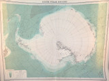
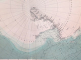
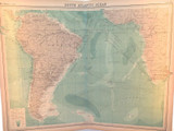
1922 RARE LARGE MAP of THE SOUTH POLE REGION. GREAT CONDITION.

$129
Condition:
Used
Shipping:
$8 (Fixed Shipping Cost)
Current stock: 0
Description

Description

This is a large double page map measuring 45cms x 58cms. It’s ex “The Times Survey Atlas of the World” 1922 & was prepared at the Edinburgh Geographical Institute under the direction of J G Bartholomew, Cartographer to the King. It's Plate No. 8, South Polar Regions. It's in superb condition & 100 years old. Vertical centre fold with hardly a mark on it. Ignore the lighter colours at the ends, it’s light reflection from behind. Looks far better than the photos depict. Will be posted rolled in a tube.
Reviews

Reviews (0)

Be the first to review this product.
Additional Info

Additional Info

Condition:
Used
Shipping:
$8 (Fixed Shipping Cost)

Related Products