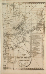
An unusual map / chart, showing the “British Channel” with England on one side & France on the other with various Invasion Dates & Sites chronicled in a chart listed in ascending date order. Dated November 1816 in bottom left hand corner. Overall measures 22.5cms x 37cms, good condition considering it’s age, over 200 years old, some foxing mainly to the outer margins. A small portion of the map, approx 1cm is missing from the left hand side. Looks better than the photos depict. Lightly hinged to acid free thin white board. Will be posted flat.


